
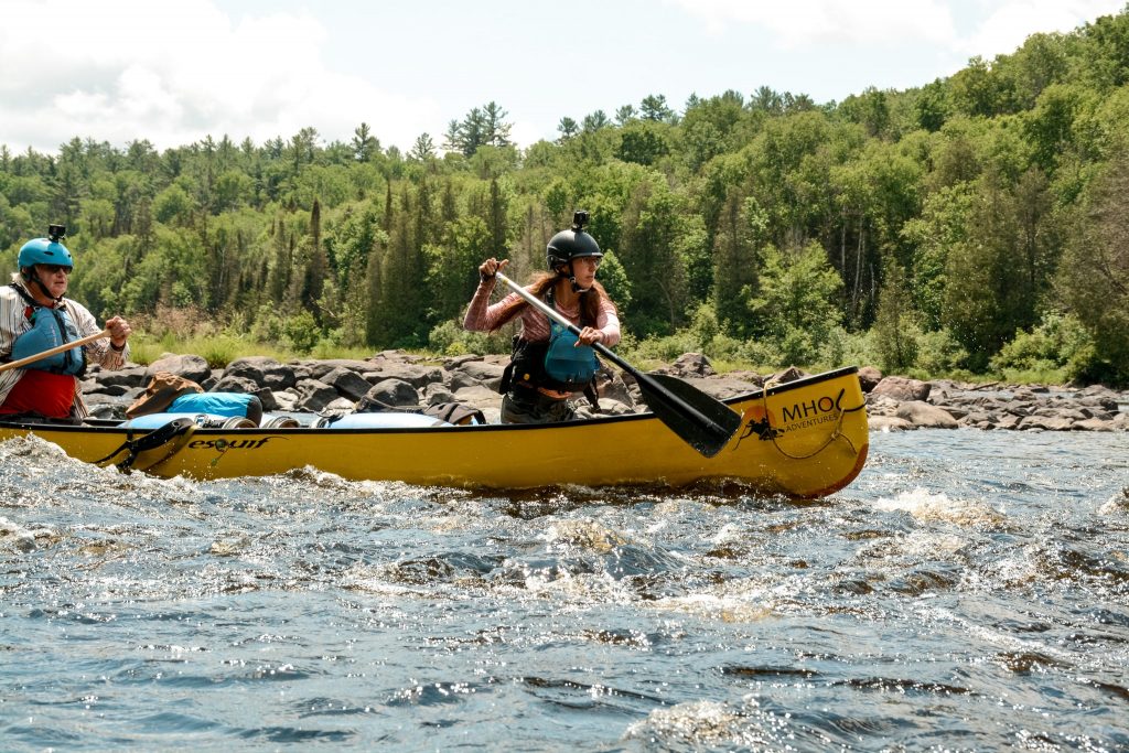
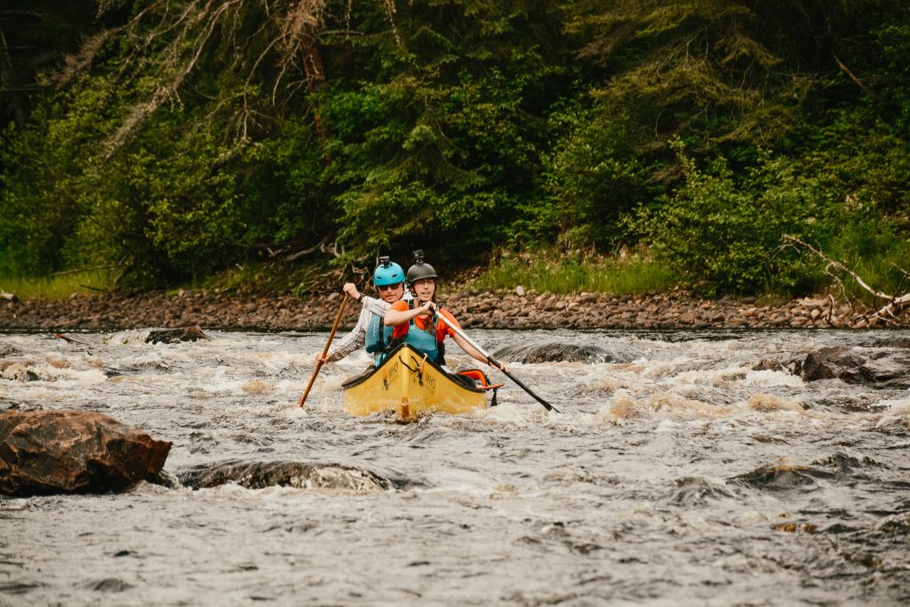
Paddlers of all varieties speak fondly of the Spanish River, as it has a little bit of everything for everyone. The river feels remote, but access points are convenient. The scenery contains sprawling boreal forest and rugged, exposed cliffs. If you like flatwater paddling, you’ll love the East Branch. If you want adrenaline-pumping whitewater, the West Branch will fit the bill.
So to help kick off your planning of a Spanish River canoe trip, I’ve put together all of the information you’ll likely need.
This post goes over:
- Maps, Permits and Campsites
- Access Points
- Oufitters and Shuttles
- Routes Ideas
I haven’t specifically talked about the individual features of the river (rapids and portages), as that’s better suited to a trip report.
If you’re interested you can find detailed trip reports for the Spanish River at the link below: Spanish River Trip Reports
About the Spanish River
The Spanish River is a Canadian Heritage River a little northwest of Sudbury Ontario. The river flows through the traditional territory of the Mississauga and Anishinabewaki ᐊᓂᔑᓈᐯᐗᑭ.
The river originates in two places: Spanish Lake and Duke Lake. From the lakes, it flows south, eventually meeting at The Forks and flowing as a single river until it empties into Georgian Bay. The two branches meet and form a single river, making the river look like a giant ‘Y’ from above.
At its longest, the Spanish River flows 338 km. However, the actual distance paddled by canoeists is much shorter than this. Most people do not start at Spanish Lake (as there is no convenient access point here) and you cannot paddle past Agnew Lake (there are hydroelectric dams afterwards).
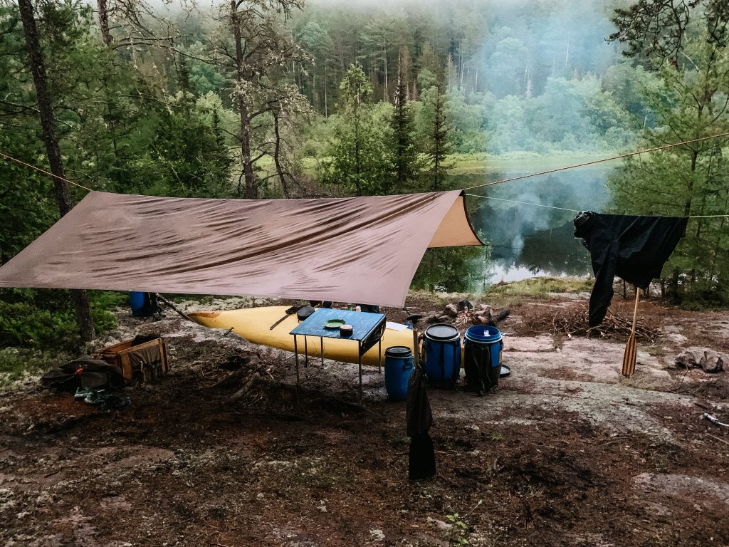
The geography of the area is classic Canadian Shield and boreal forest. The campsites are located on a mix of rock and sand. The river flows in the usual drop-and-pool style of Ontario rivers.
The river is protected by Ontario Parks and operates as a ‘backcountry’ park, meaning there are limited facilities and no front-country camping. One highlight along the river is the red pine trees – Spanish River Provincial Park protects thousands of hectares of old-growth forest.


This post may contain affiliate links. If you make a purchase through one of these links, I may receive a small commission at no extra cost to you. Your support is much appreciated! You can learn more by reading my full disclosure.
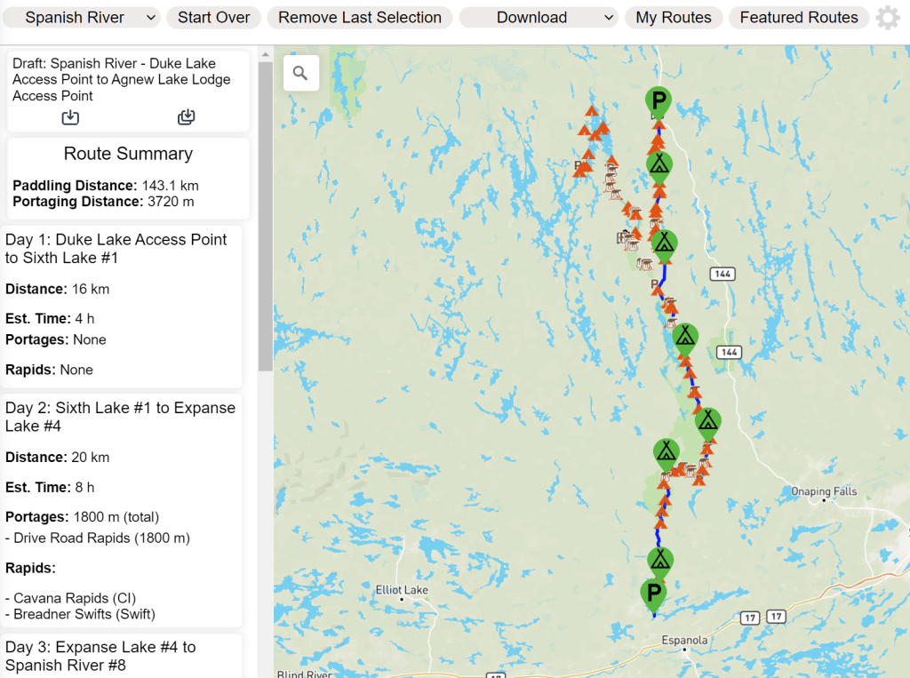
Spanish River Canoe Trip Map
Route Planning Map
This was our route on the Spanish River. Click here to view the interactive map in a new tab.
Paper Map for Navigation
Spanish River Adventure Map by Chrismar. This map has all of the rapids, portages and campsites accurately marked and contains information on the river’s history and geography throughout.
Spanish River Canoe Trip Video
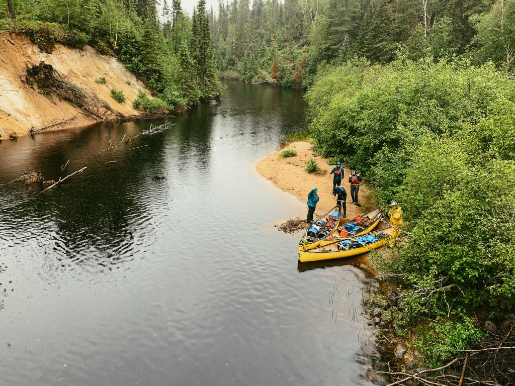
In the summer of 2021, I paddled the East Branch of the Spanish River from Duke Lake to Agnew Lake. If you’re interested in seeing some of the scenery, campsites and whitewater check out the video!
Permits and Campsites
Permits
A backcountry camping permit is needed to camp on the river. Permits can be purchased through the Ontario Parks Reservation Portal by selecting ‘Backcountry Registration’ and then ‘Spanish River & Biscotasing Lake Provincial Park’. You can then select your access point.
From there, you select which ‘zone’ you’ll be camping in for each night of your trip. The zones break down like this:
- Zone 1: Biscotasing Lake
- Zone 2: West Branch
- Zone 3: East Branch
- Zone 4: The Forks to the Elbow
- Zone 5: The Elbow to Agnew Lake
Campsites
Once you’re in a zone, campsites are first-come-first-serve.
You can read complete campsite descriptions in the Spanish River trip reports, but here are a few highlights and tips.
- Upper Athlone Rapids – beautiful campsite
- Mogo Creek – amazing island campsite
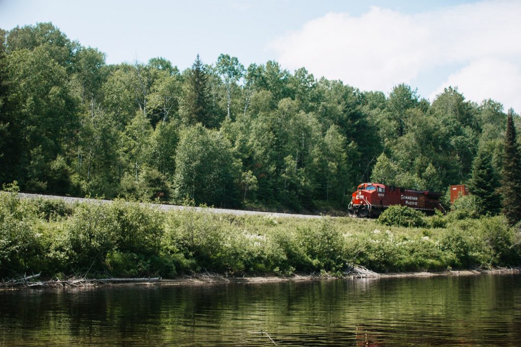
- Pogamasing – excellent site around here, but you can hear the train in the distance
- Agnew Lake – the last campsite before Agnew Lake is huge and super flat
- Cedar Rapids – the campsite right before cedar rapids has a terribly steep put in that can be super muddy (and slippery)
- East Branch campsites – Generally speaking, there is a campsite at the beginning and end of each lake. The beginning campsite is almost always better than the ending campsite.


Spanish River Access Points
Parking along the Spanish River
Before we dive into specific access points, there is the question of whether you can long-term park at the access points. If you’re putting in on the East Branch or after the Fork, you may want to do a self-shuttle and leave your cars at the access points at the start or end of your route.
With the exception of Agnew Lake, you can park for free at each of the road-accessible access points listed below. It’s recommended that you have your backcountry camping permit for Spanish River Provincial Park printed and visible on your dashboard.
Is it safe to park? Of course, there is always the risk that something will happen to your car while it is unattended, but this is a risk most backcountry campers face and there are very few incidents of theft or vandalism relative to the number of people who park while camping.
East Branch Access Points
Duke Lake Access Point – Duke Lake is where the east branch of the Spanish River begins. The put-in is easily accessed from Highway 144 (coincidentally, the put-in is exactly 144 km north along Highway 144 after you turn off Highway 17). You’ll turn west onto Duke Lake Road; immediately following, there are two parts to the put-in and you can use either one.
There aren’t really any other places to access the East Branch until you get to Forks. There’s a logging road and bridge that crosses the point in between Third and Second Lake, but I don’t believe it’s a viable access point. If anyone reading this has tried it though, let me know!
West Branch Access Points
Access points along the West Branch are not road-accessible. Instead, you’ll need to book a one way ticket on Via Rail to your access point. There are few things as Canadian as catching a train to your canoe put in! Below I’ve included instructions on how to book your tickets, since there are a few additional considerations you’ll need to make for transporting your canoe.
Biscotasing Lake – Biscotasing Lake (also known as Bisco) is the northernmost point to start the Spanish River on the West Branch. I’ve heard this is the most popular access point for whitewater paddlers since it allows you to paddle the entirety of the West Branch. That said, you’ll have a day of lake paddling from Bisco Lake to the start of the Spanish River.
Sinker Creek – For those with less time or wanting to avoid lake paddling, you can start at Sinker Creek instead (the train station before Bisco). Sinker Creek flows into the Spanish River over a couple of kilometers and from there you can start your Spanish River adventure!
Forks – Forks is where the East and West branches meet. This access point is only accessible by Via Rail, and there’s a station a little north of The Forks on the West Branch. If you have only a few days to spend on the river, this is a great put in.
Access Points after Forks
The West Branch and East Branch meet at Forks.
Sheahan and Pogamasing – These are the two Via Rail stops directly before Forks, though I don’t know anyone who has chosen to start at either of these access points, as they aren’t very far from the Forks and would only save a half day of paddling.
Bannerman Creek – A less common access point, Bannerman Creek is road accessible and lies a little upriver to The Elbow.
The Elbow – The next and final access point along the river is The Elbow. This is a road-accessible access point that is a popular take out, since it avoids Agnew Lake (where you have to pay for parking and paddle 8 km on a big, windy lake).
Agnew Lake – Agnew Lake is the most popular takeout point on the Spanish River. Although the Spanish River eventually empties into Georgian Bay, Agnew Lake is the furthest south you can paddle. There is a hydroelectric dam downriver to Agnew Lake, making the rest of the river inaccessible by canoe. Plus, the Agnew Lake Lodge is a convenient place to leave your car.
I haven’t described absolutely every possible access point, but the ones above are the most practical and widely used.
Taking the Train to Your Access Point
None of the ‘stations’ mentioned above are proper train stations, nor is this a proper passenger route, so you can’t book a ticket through the Via Rail website. The Via Rail train from Sudbury to Bisco (and beyond!) is a baggage service car, also know as the Budd Car Company (more info here). It can accommodate 12 canoes.
In order to book your ticket, you’ll need to call Via Rail (1-888-VIA-RAIL) and book through an agent.
Prior to boarding your train, ensure you remind an operator which ‘station’ you’re getting off at. Sometimes wires get crossed and the operator doesn’t know which station you want to get out at.
Outfitters & Shuttles
Rentals
Spanish River Outfitters – This outfitter provides gear rentals, including canoes. You can contact them here.
Agnew Lake Lodge – In addition to parking, Agnew Lake Lodge can also provide you with canoe rentals.
Shuttles
Fox Lake Lodge – Fox Lake Lodge is able to shuttle you (either in your vehicle or theirs) to the Elbow and Duke Lake. They can also arrange to have your car waiting for you at your take-out. You can read more about their services here.
Guided Trips
MHO Adventures – MHO runs a Spanish River trip (or a few) each season. Last year my dad and I joined MHO for a 7-day trip from Duke Lake to Agnew Lake in 2021 and had a great time. This year they’re running a 6-day trip from Forks to Duke Lake. Click here to view the trip.
Black Feather – Black Feather also offers a guided trip on the Spanish River. Their trip kicks off at Bannerman Creek and ends at Agnew Lake for a total of five days. Click here to view the trip.

Spanish River Canoe Routes
Full West Branch: Biscotasing Lake to Agnew Lake
- Put In: Biscotasing Lake
- Take Out: Agnew Lake
- Distance: 164 km
- Number of Days: 6-7 days
- Highlights: Paddles the West Branch from source to end, longest route on the Spanish River, every single rapid
Full East Branch: Duke Lake to Agnew Lake
- Put In: Duke Lake
- Take Out: Agnew Lake
- Distance: 142 km
- Number of Days: 6-7 days
- Highlights: Lake travel for first 2-3 days and some whitewater for 3-4 days, no train needed, great for a self-shuttle
Trip Report: Spanish River East Branch: Duke Lake to Agnew Lake (7 days / 142 km) – Coming Soon
West Branch: Sinker Creek to Agnew Lake
- Put In: Sinker Creek
- Take Out: Agnew Lake
- Distance: 130 km
- Number of Days: 4-5 days
- Highlights: Convenient whitewater route, avoids some lake travel while hitting almost all rapids
Trip Report: Spanish River West Branch: Sinker Creek to Agnew Lake (5 days / 130 km)
The Forks to Agnew Lake
- Put In: Sinker Creek
- Take Out: Agnew Lake
- Distance: 97 km
- Number of Days: 3-4 days
- Highlights: Good route for those with limited days, convenient parking (paid) and takes the train, some whitewater rapids and portages
West Branch: Sinker Creek to The Elbow
- Put In: Sinker Creek
- Take Out: Elbow
- Distance: 78 km
- Number of Days: 3-4 days
- Highlights: Condensed West Branch maximizes whitewater while avoided all lake travel
The Forks to The Elbow
- Put In: Forks
- Take Out: The Elbow
- Distance: 45 km
- Number of Days: 2-3 days
- Highlights: Good route for those with even fewer days, free parking at take out and train taken to put in (too much coordination for a short trip, in my opinion), avoids big lake travel


Spanish River Canoe Trip: Final Thoughts
I hope you’ve found this guide helpful and are ready to kick off planning your Spanish River canoe trip! If you have any questions, please send me a DM on Instagram and I’ll do my best to point you in the right direction.
And don’t forget to check out my Spanish River trip reports, as those will be the most helpful in planning your route!
MY FAVOURITE GEAR
Fleece Sweater
Down Jacket
Hiking Boots
Hiking Shirt
Back Pack
Hiking Pants